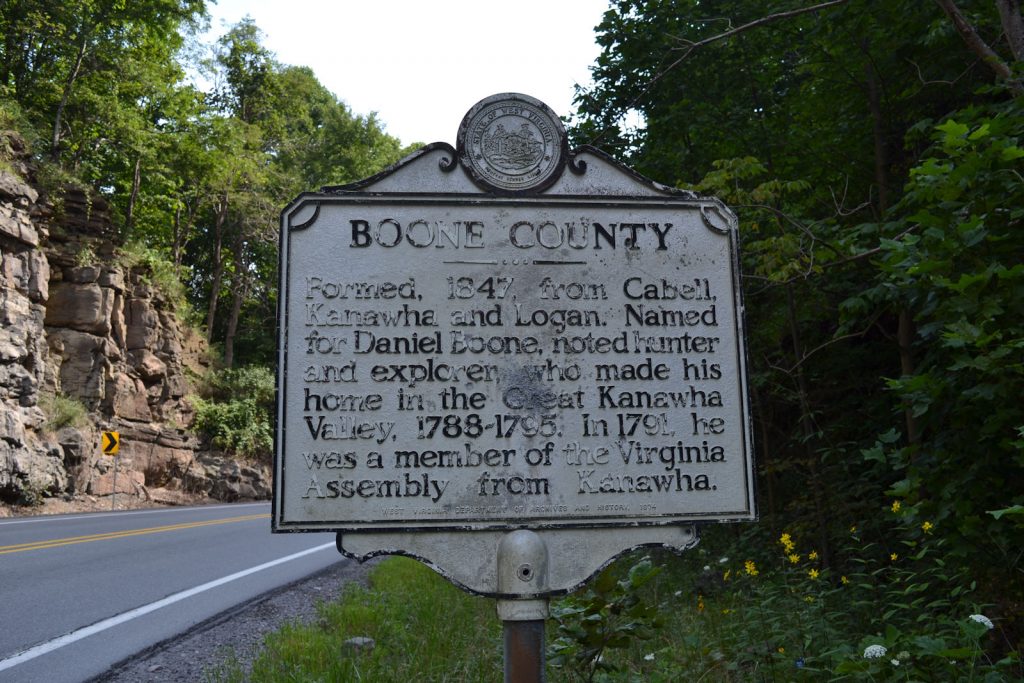
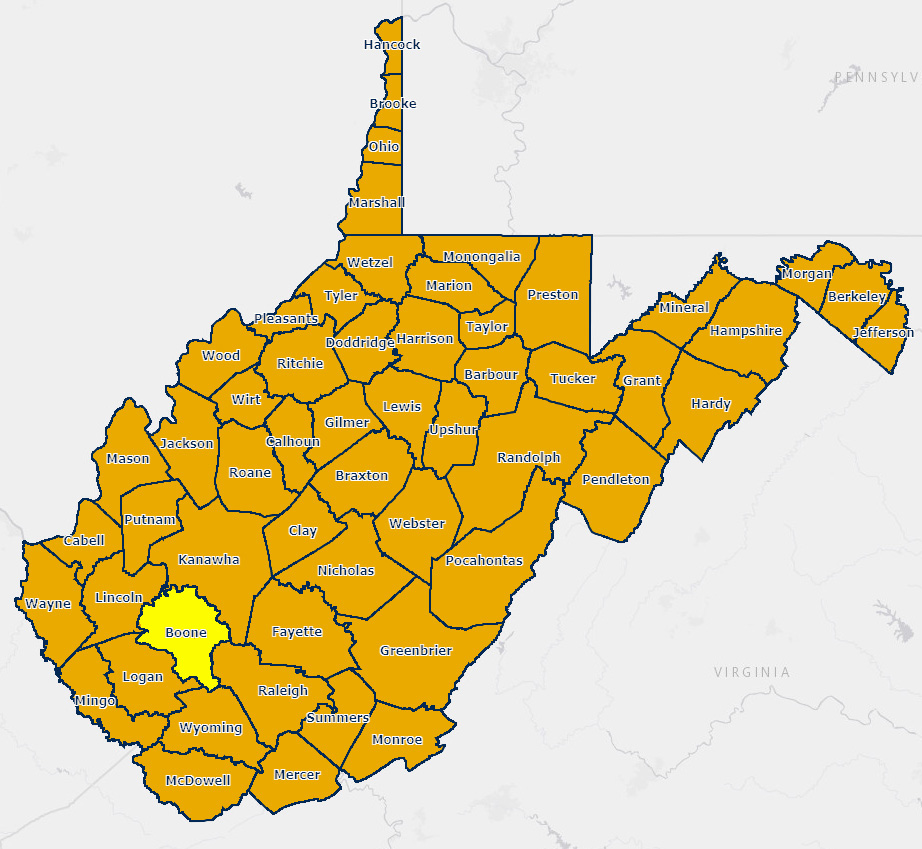
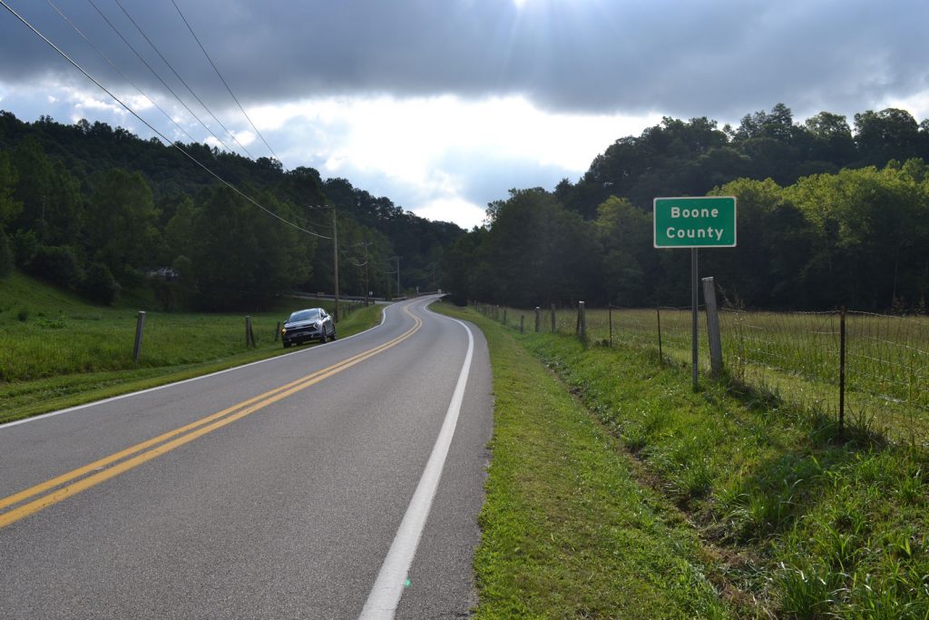
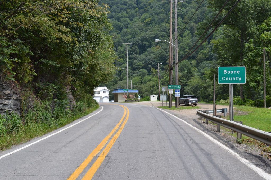
Boone County
Boone County is located in south-west West Virginia. The population in 2020 was 20,809. The county seat is Madison and the main industries are coal, lumber, and natural gas.
Major cities in Boone County include Madison, Danville, and Whitesville.
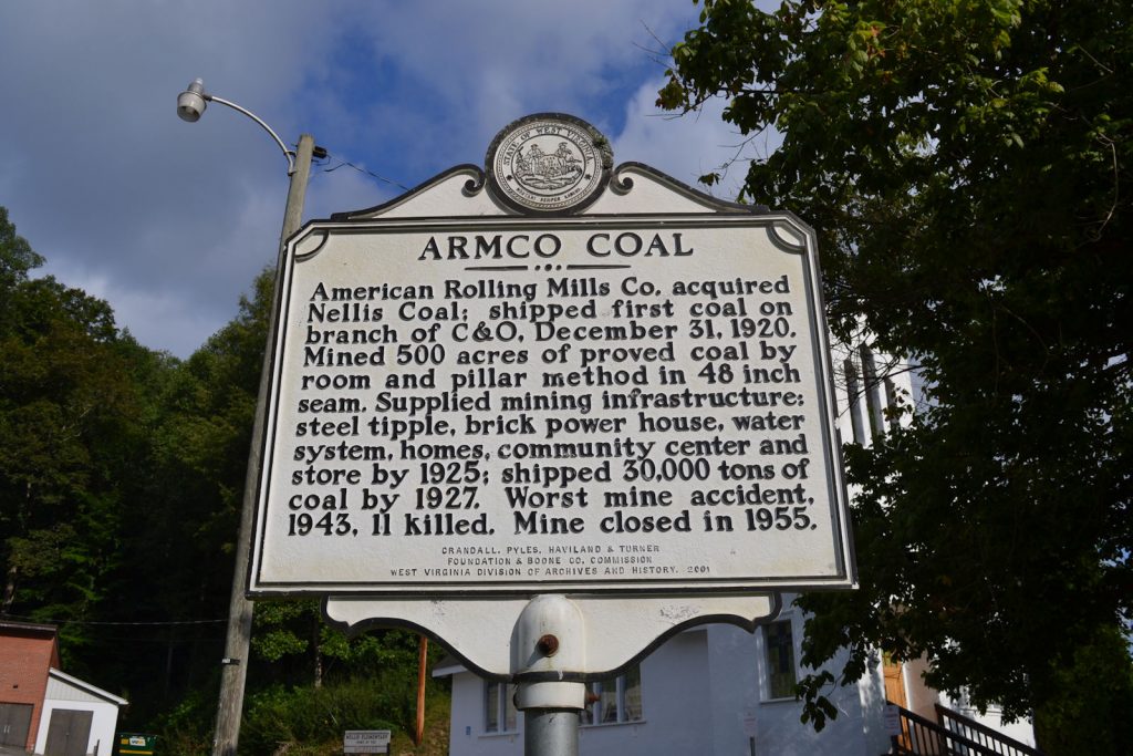
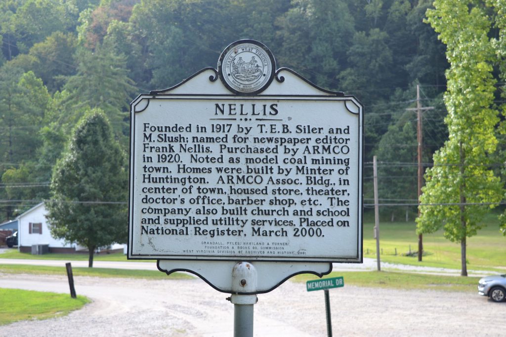
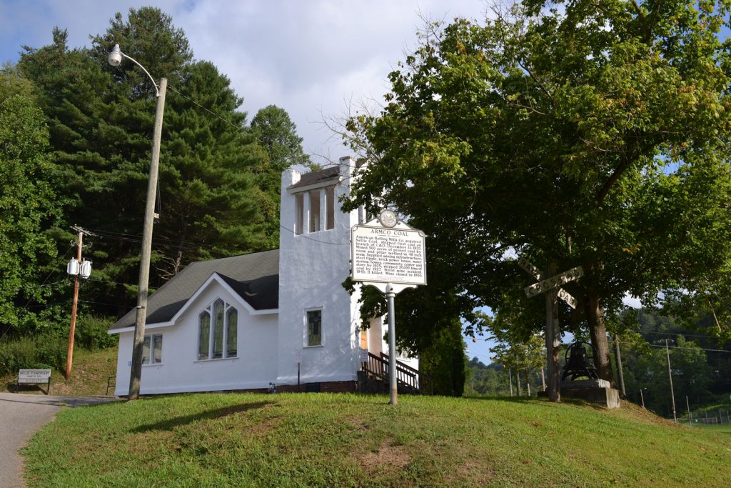
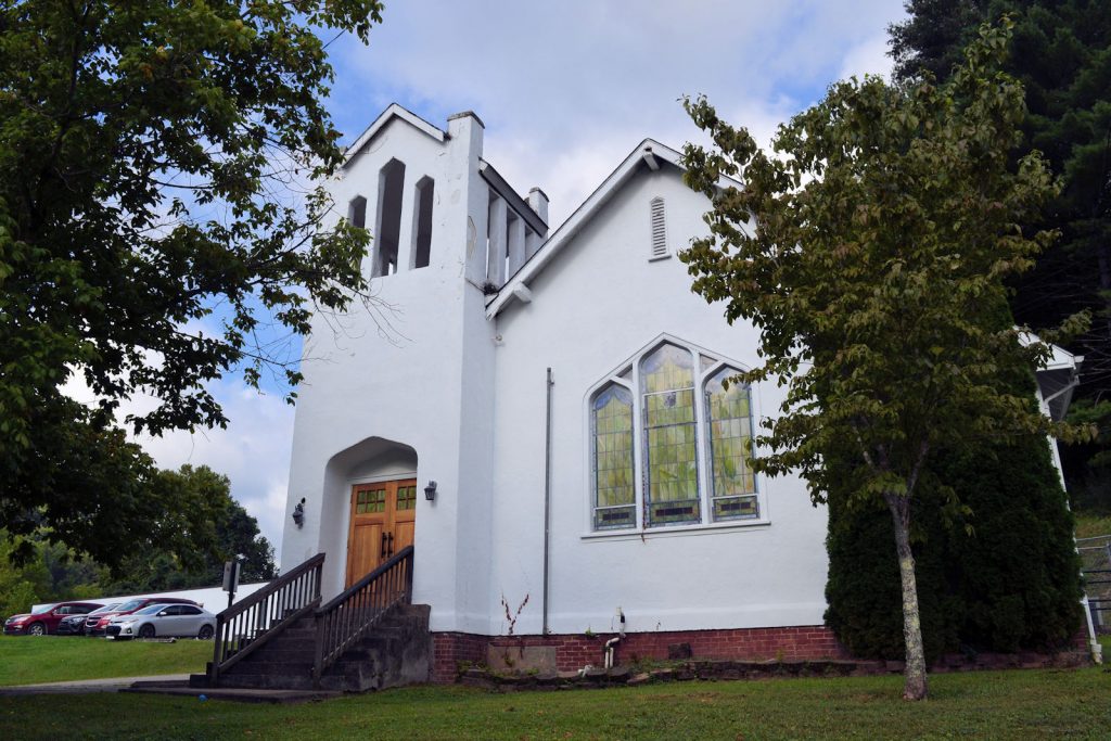
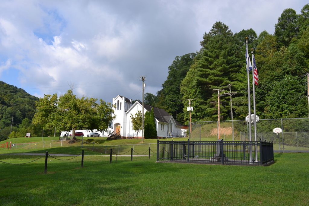
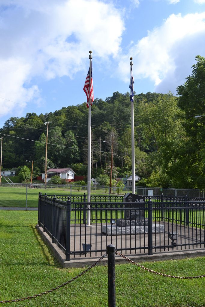
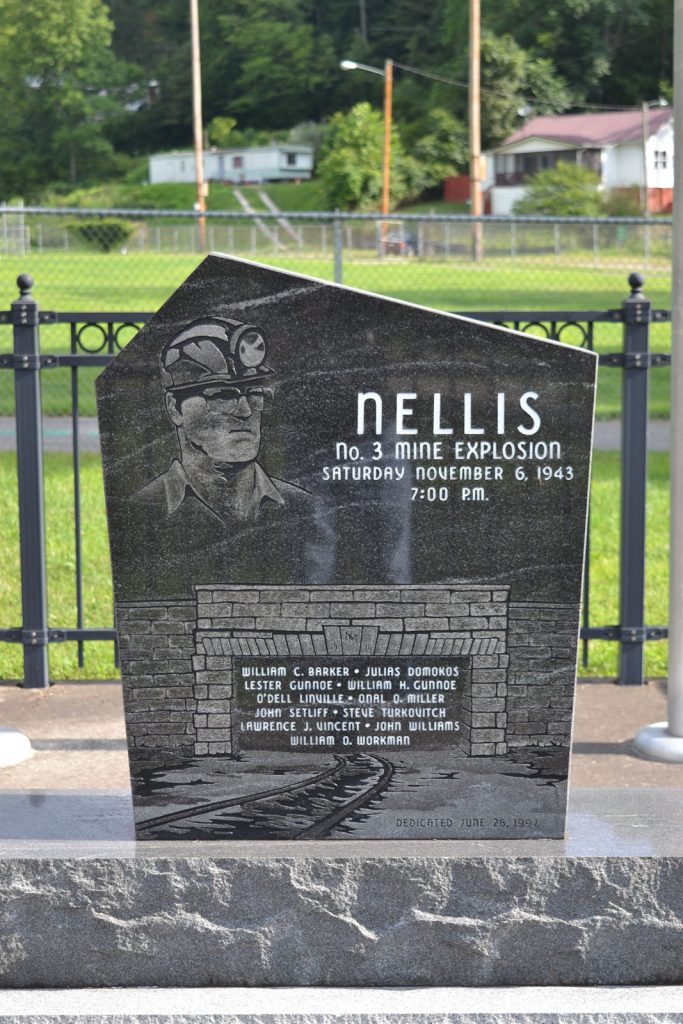
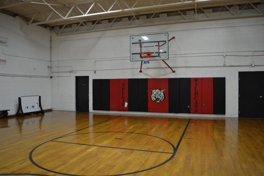
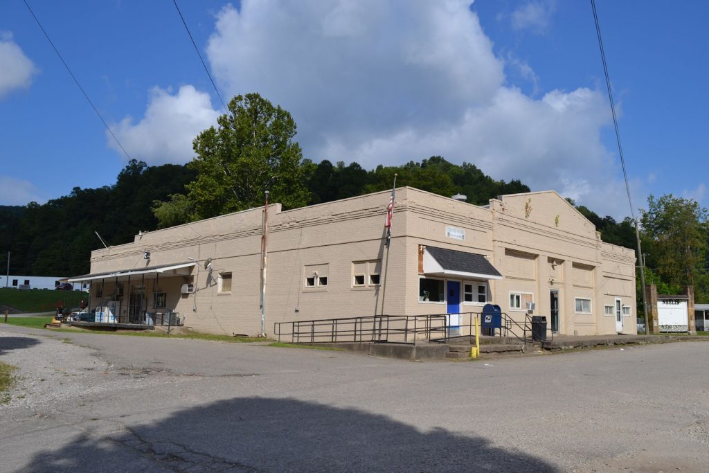
ARMCO COAL / NELLIS
Location: Nellis, CR 1, Appx 5 miles west of Peytona, appx 10 miles north-east of Madison, located appx 75 yards north of highway next to a large building, gravel frontage road
PHOTOS 18 AUGUST 2023
GPS:
38* 90′ 00″ N, 81* 44′ 38″ W
38.150072 N, 81.744145 W

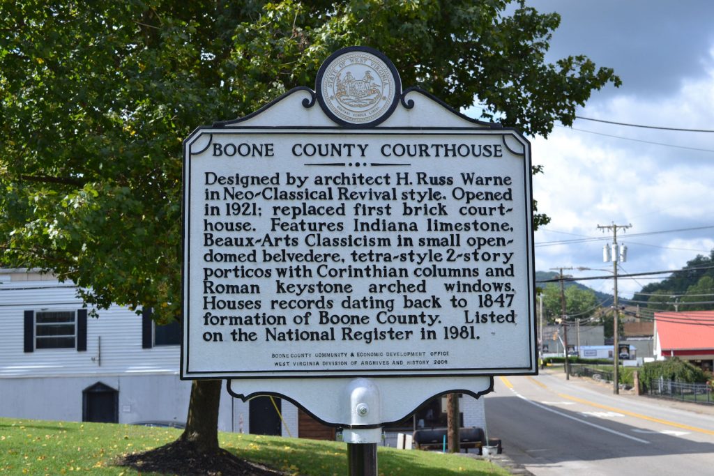
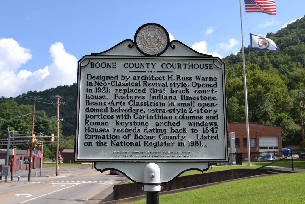
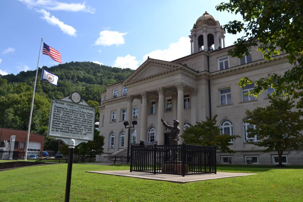
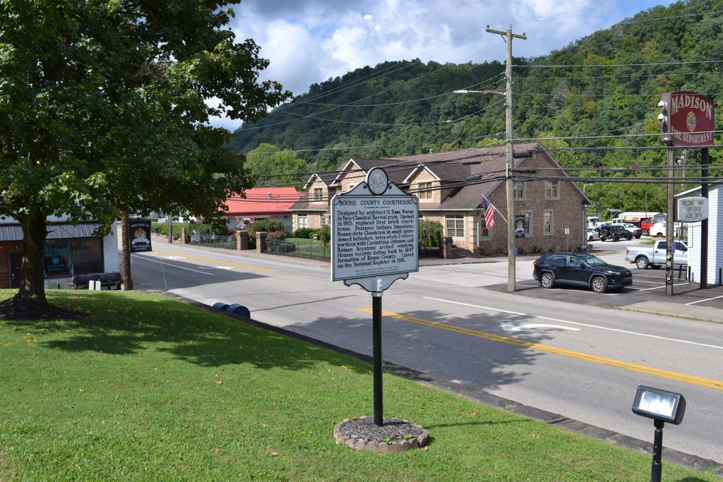
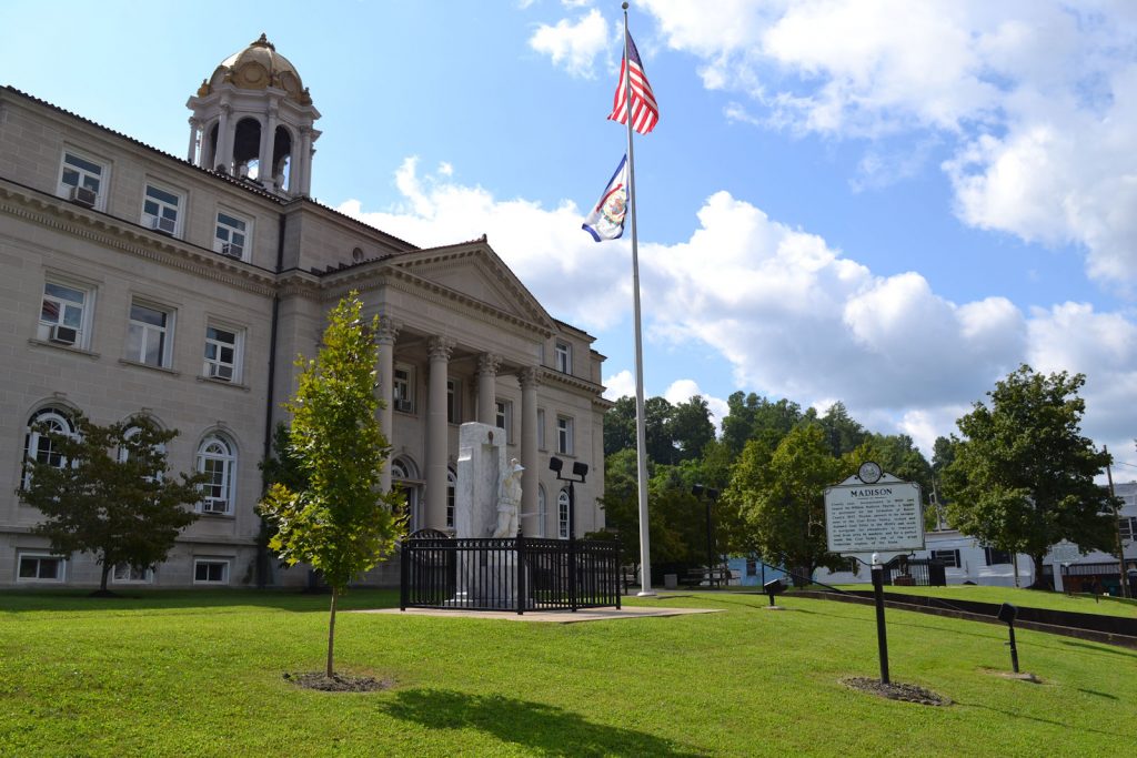
BOONE COUNTY COURTHOUSE
Location: Madison, State Street (Rt 85) in front of courthouse, on right side (south) facing the courthouse (Appx 100 feet from Madison marker)
PHOTOS 18 AUGUST 2023
GPS:
38* 03′ 59″ N, 81* 49′ 10″ W
38.066403 N, 81.819573 W
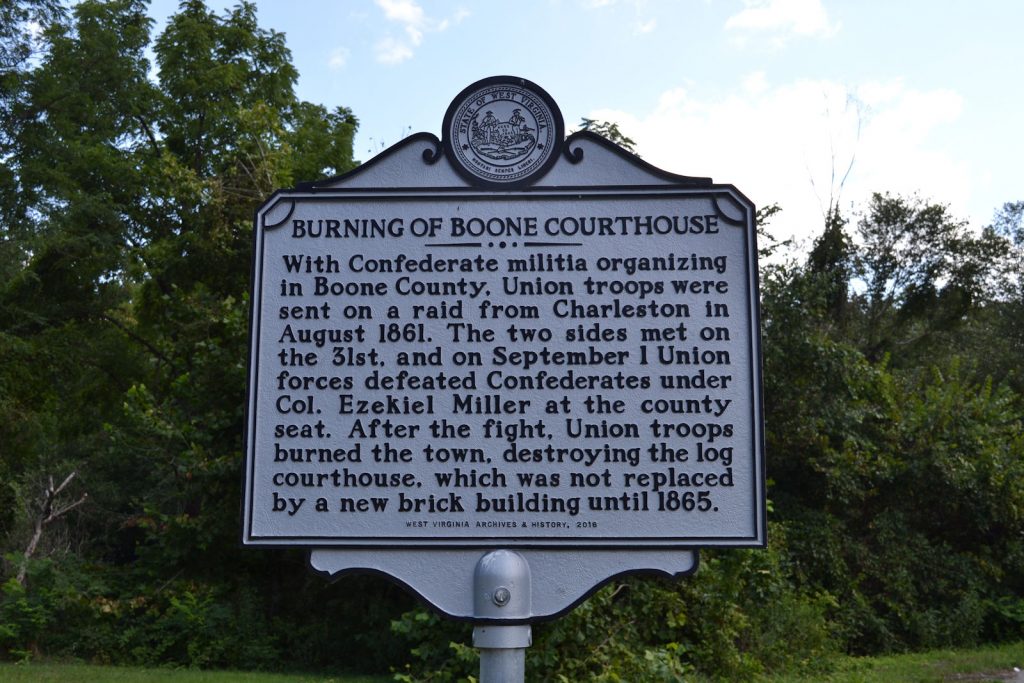
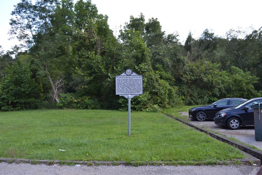
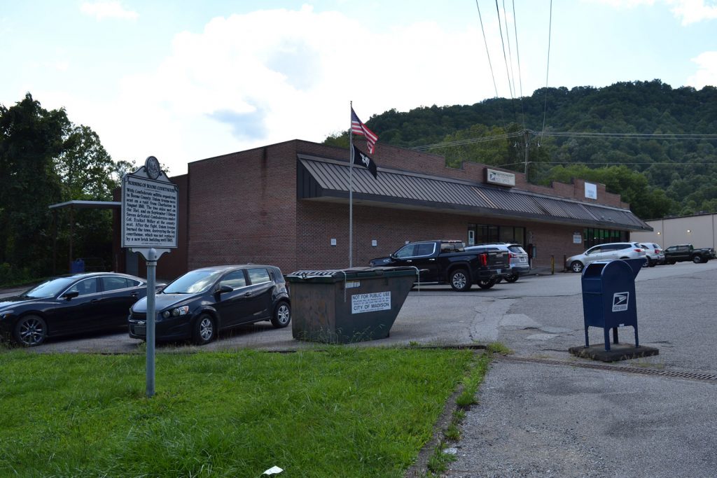
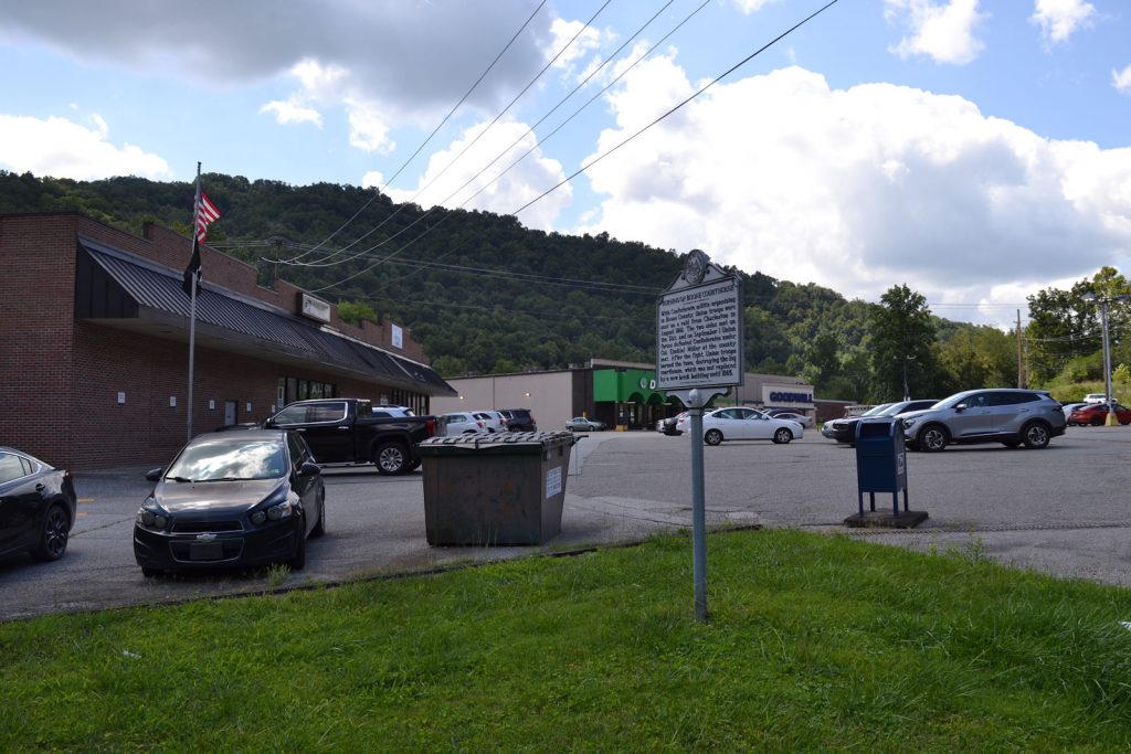
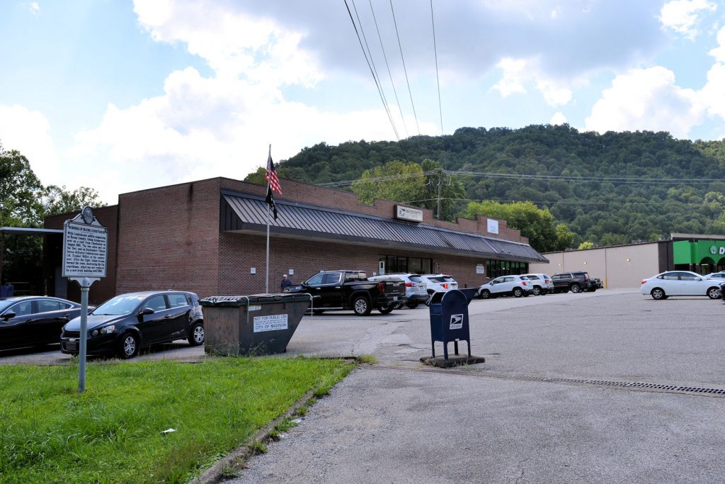
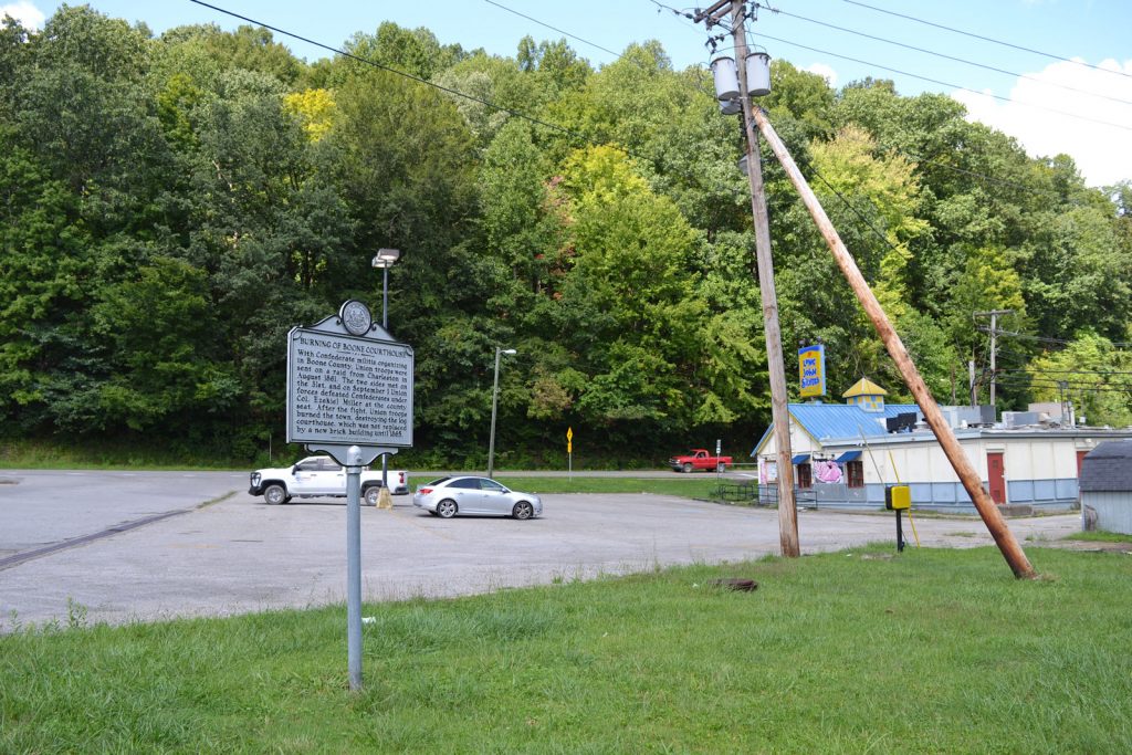
BURNING OF BOONE
COURTHOUSE
MOVED TO NEW LOCATION: Spruce River Road (RT 17) next to Madison Post Office, Appx 8/10 mile south of courthouse, situated appx 150 feet away from highway in small shopping center parking lot.
PHOTOS 18 AUGUST 2023
NEW LOCATION GPS:
38* 03′ 27″ N, 81* 49′ 28″ W
38.057672 N, 81.824546 W
Old Location: N/E Madison, Riverside Drive (Veterans’ Memorial Bypass), between 5th Ave and 6th Ave, near Scott High School

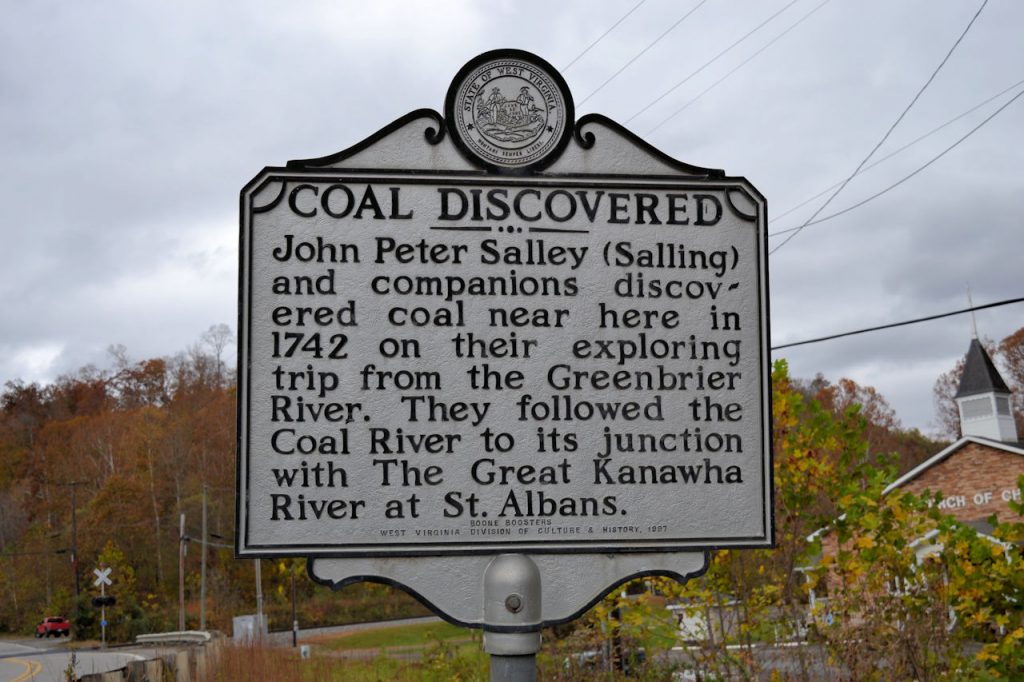
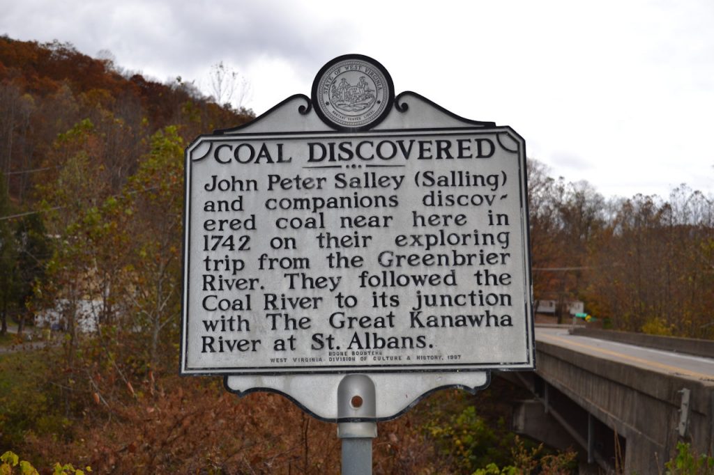
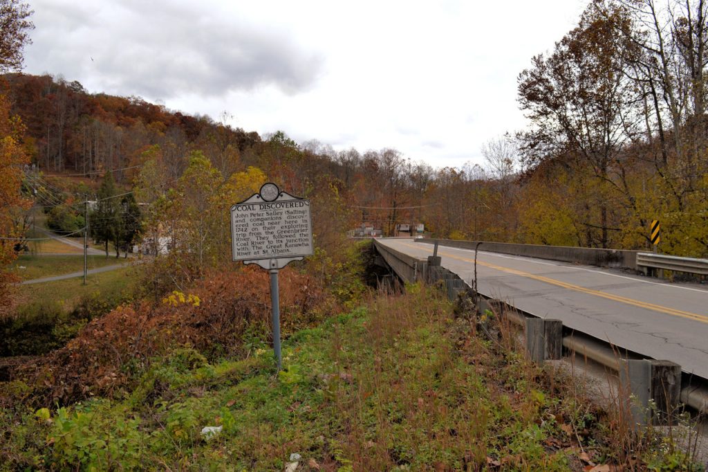
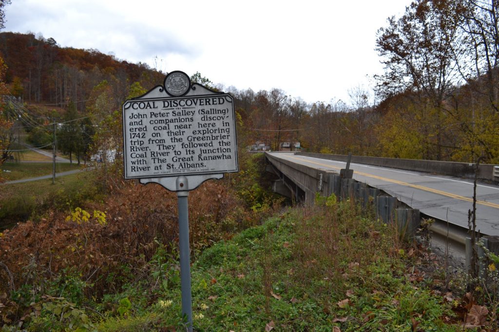
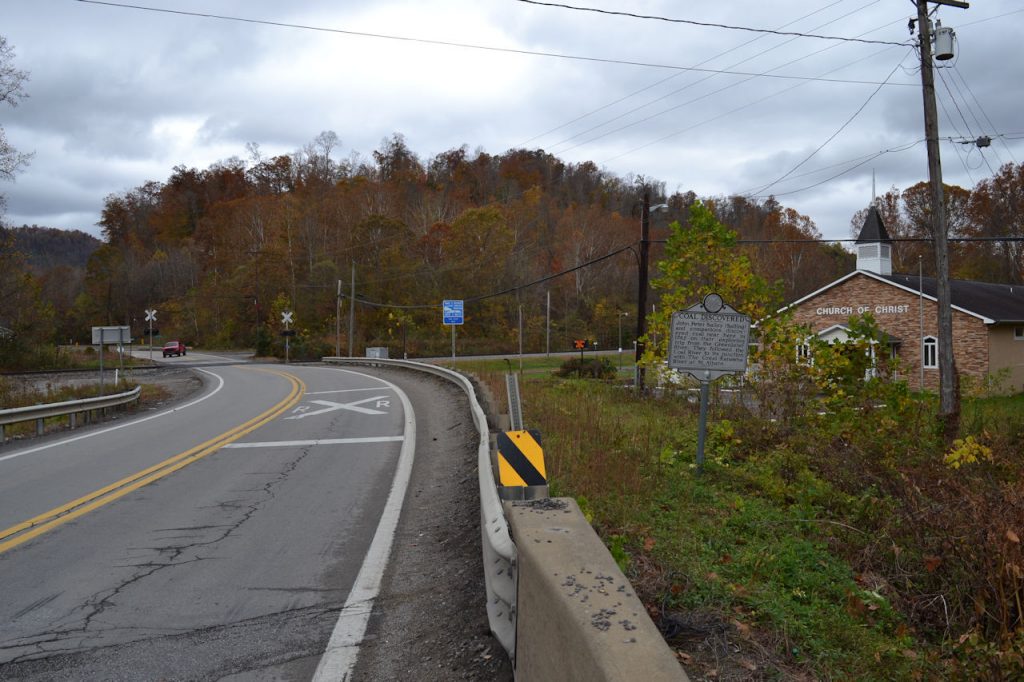
COAL DISCOVERED
Location: Peytona, Rt 3, between Costa Road and Roundbottom Road, appx 12 miles N/E of Madison
PHOTOS 26 OCTOBER 2022
GPS:
38* 08′ 12″ N, 81* 40′ 47″ W
38.136793 N, 81.679955 W
INDIAN CAMP
Location: Appx 1/2 mile west of Peytona, Rt 3, by Drawdy Falls Roadside Park, next to John Edward Kenna marker
PHOTOS 26 OCTOBER 2022
** MARKER AND POLE MISSING 26 OCTOBER 2022 **
GPS:
38* 08′ 04″ N, 81* 41′ 14″ W
38.134469 N, 81.687431 W
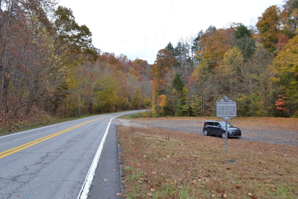
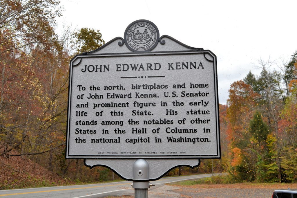
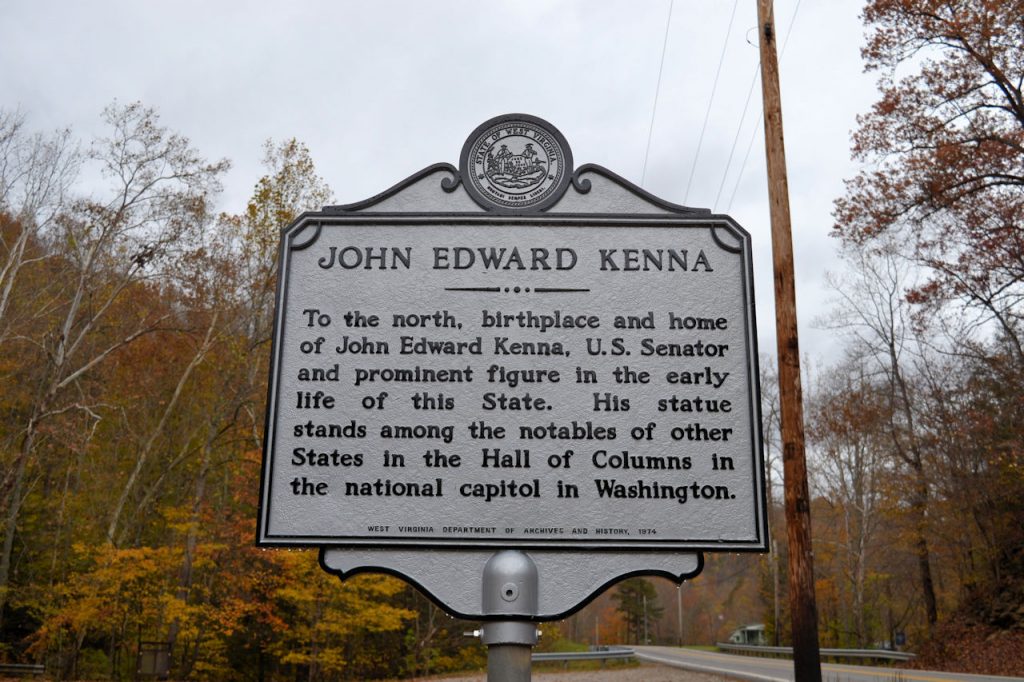
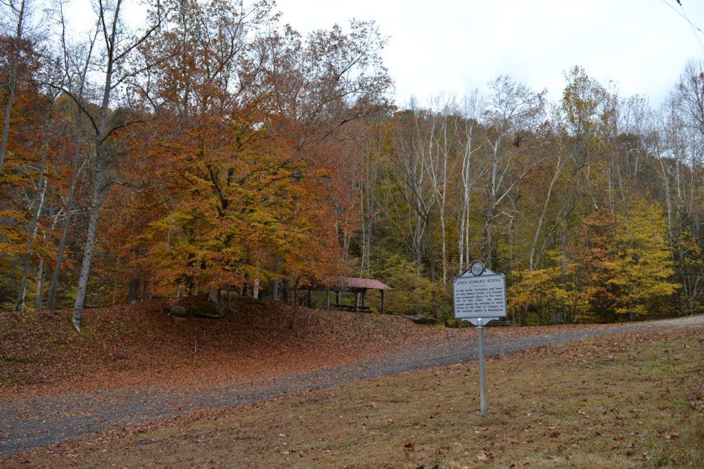
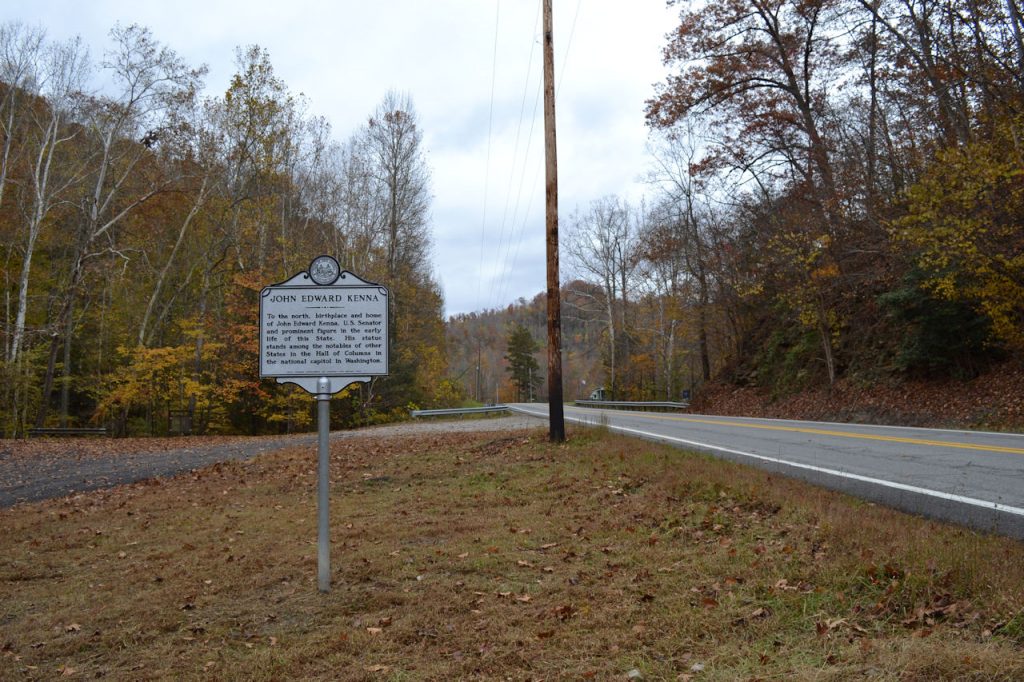
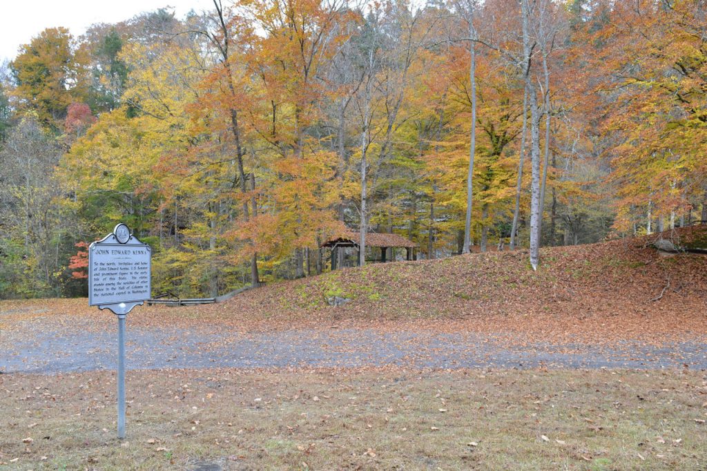
JOHN EDWARD KENNA
Location: Appx 1/2 mile west of Peytona, Rt 3, by Drawdy Falls Roadside Park, next to Indian Camp marker (Missing)
PHOTOS 26 OCTOBER 2022
GPS:
38* 08′ 04″ N, 81* 41′ 14″ W
38.134528 N, 81.687339 W
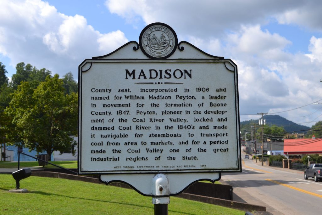
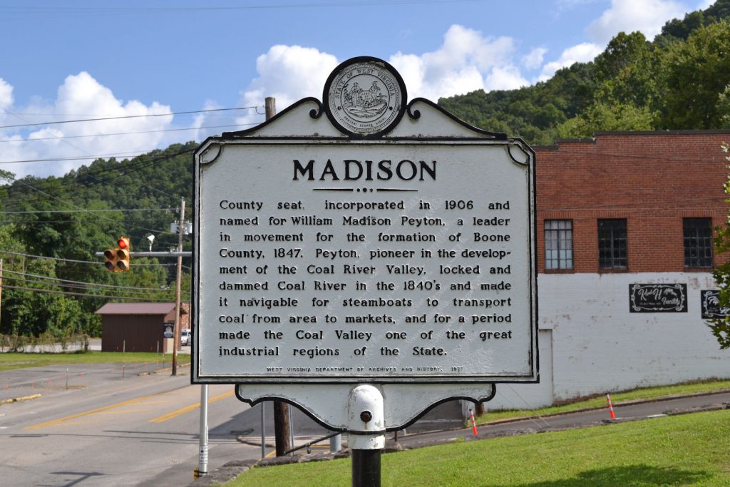
MADISON
Location: Madison, State Street (Rt 85) in front of courthouse, on left side (north) facing the courthouse (Appx 100 feet from Boone County Courthouse marker)
PHOTOS 18 AUGUST 2023
GPS:
38* 04′ 00″ N, 81* 49′ 09″ W
38.066788 N, 81.819345 W
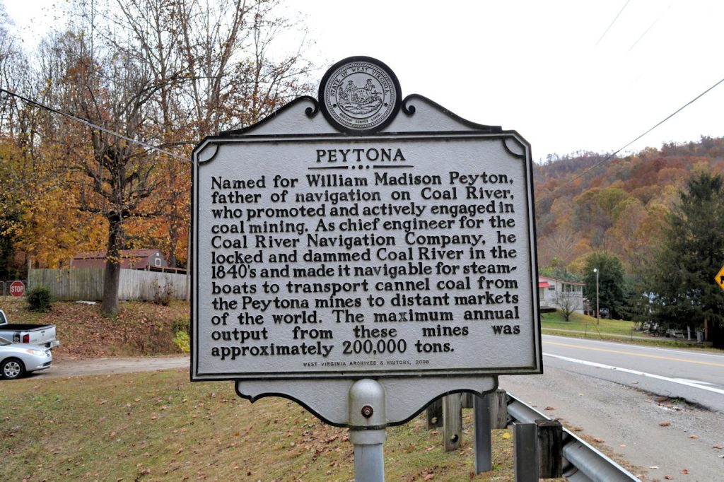
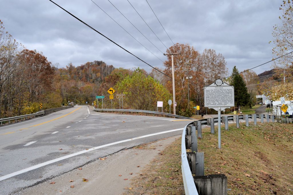
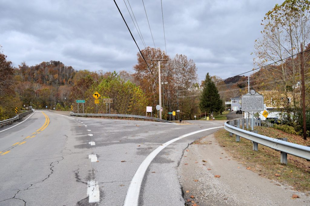
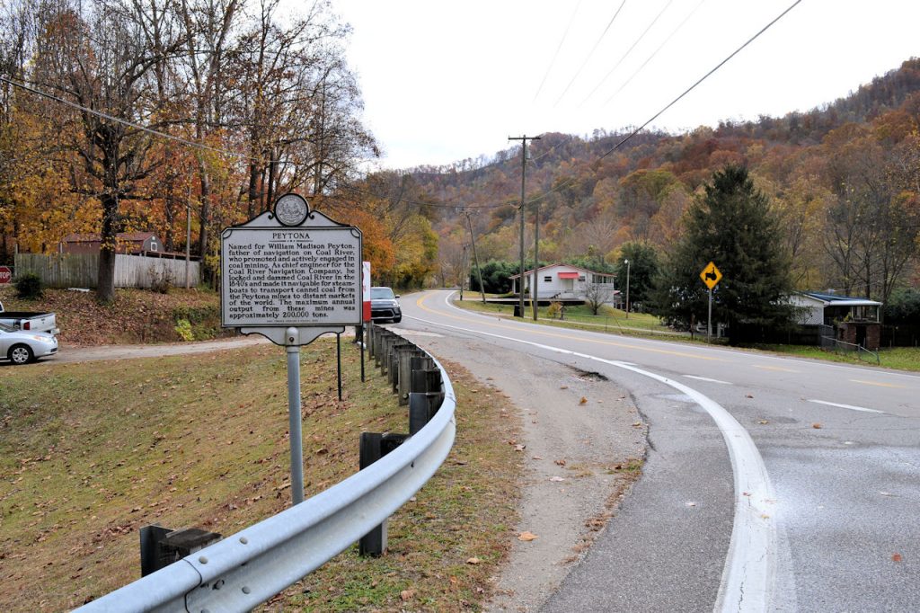
PEYTONA
Location: Peytona, Rt 3, at junction with Roundbottom Road (CR 119/21)
PHOTOS 26 OCTOBER 2022
GPS:
38* 08′ 11″ N, 81* 40′ 41″ W
38.136658 N, 81.678195 W


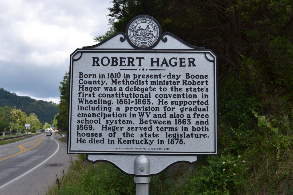
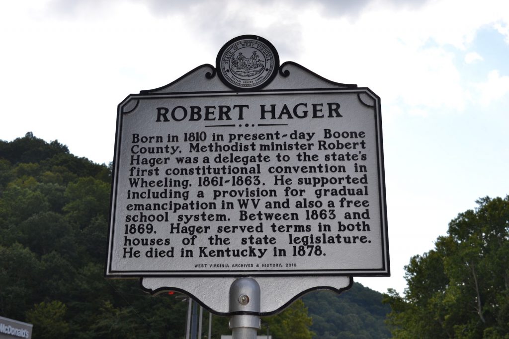
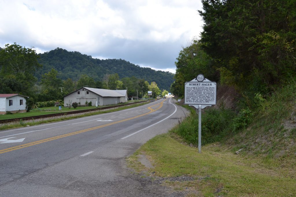
ROBERT HAGER
Location: Madison, Rt 85, appx 3/4 mile north of Boone Co Courthouse, 100 yards north of junction with Delta Road 12 (Next to Kroger/McDonalds)
PHOTOS 18 AUGUST 2023
GPS:
38* 04′ 26″ N, 81* 49′ 24″ W
38.073937 N, 81.823372 W

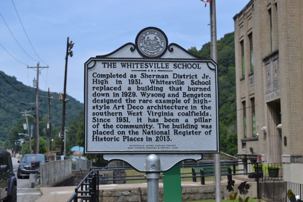
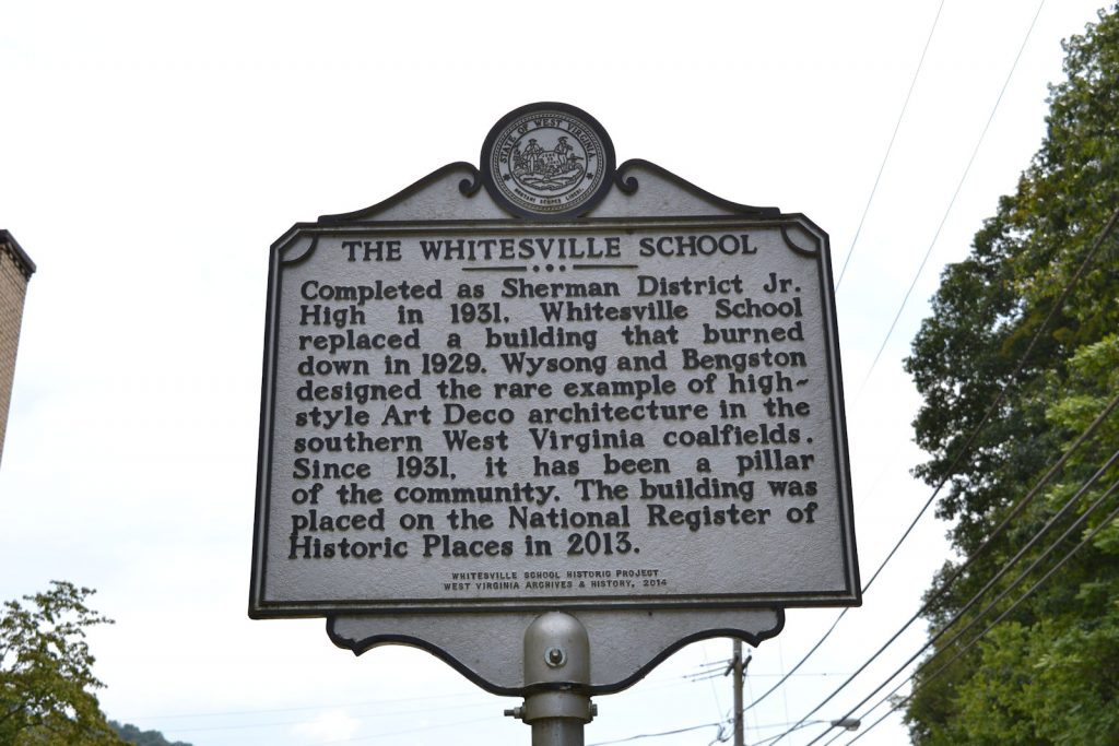
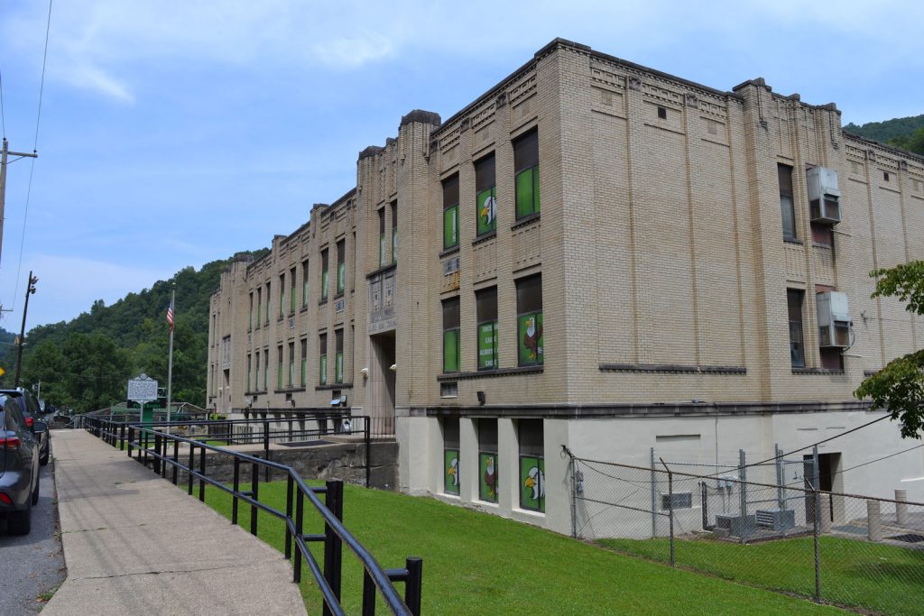
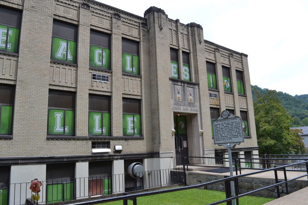
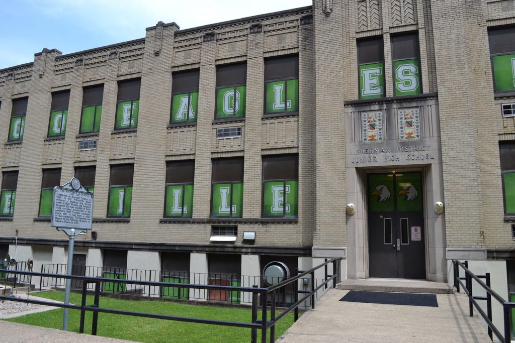
THE WHITESVILLE SCHOOL
Location: Whitesville, Rt 3, appx 100 yards north of Upper Big Branch Miners’ Memorial, in front of school
Photos 21 August 2023
GPS:
37* 58′ 54″ N, 81* 32′ 08″ W
37.981937 N, 81.535823 W
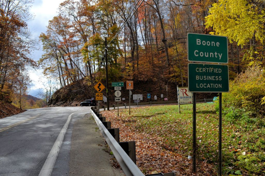
Boone County /
Kanawha County
Location: Rt 119, appx 6 miles south of Alum Creek, appx 10 miles north of Madison
PHOTOS 18 AUGUST 2023
MISSING ON 18 AUGUST 2023
GPS:
38* 12′ 26″ N, 81* 49′ 50″ W
38.207323 N, 81.830579 W
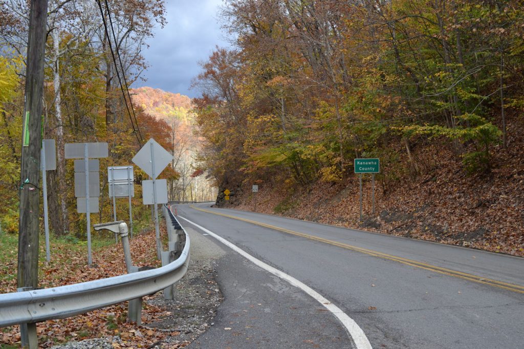
Boone County /
Kanawha County
Location: Rt 94, appx 7 miles southwest of Marmet and I-64, At Nellis Road
PHOTOS 26 OCTOBER 2022
** MISSING – BROKEN OFF AT POLE **
GPS:
38* 10′ 39″ N, 81* 38′ 11″ W
38.177607 N, 81.636664 W
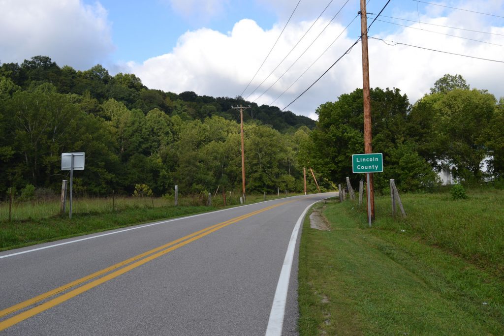
Boone County /
Lincoln County
Location: Rt 3, appx 1-1/2 miles west of Rt 119 and Julian
MISSING ON 18 AUGUST 2023
PHOTOS 18 AUGUST 2023
GPS:
38* 09′ 52″ N, 81* 52′ 16″ W
38.164644 N, 81.871138 W
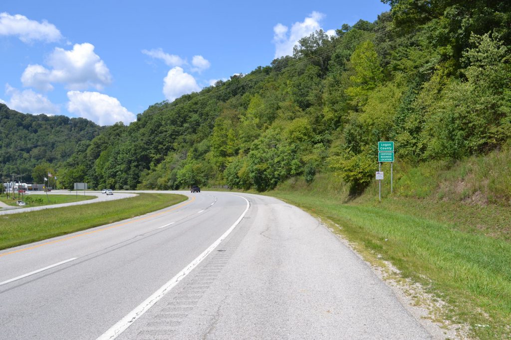
BOONE COUNTY /
LOGAN COUNTY
Location: Rt 119, appx 3 miles north of Chapmanville, appx 12 miles south of Madison
PHOTO 18 AUGUST 2023
MISSING 18 AUGUST 2023
GPS:
37* 59′ 31″ N, 81* 58′ 51″ W
37.992103 N, 81.981058 W
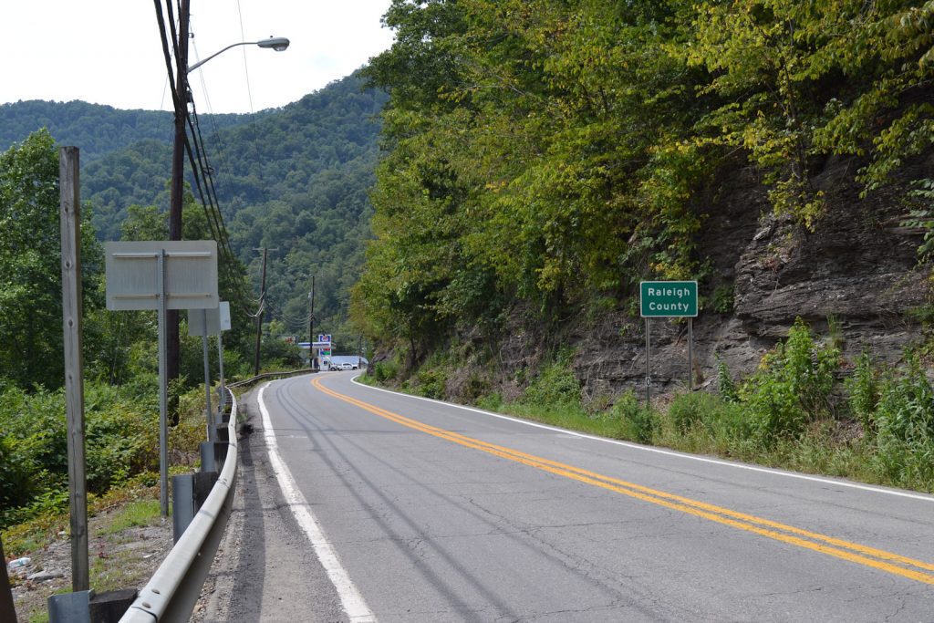
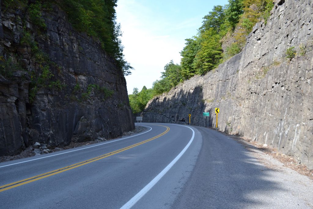
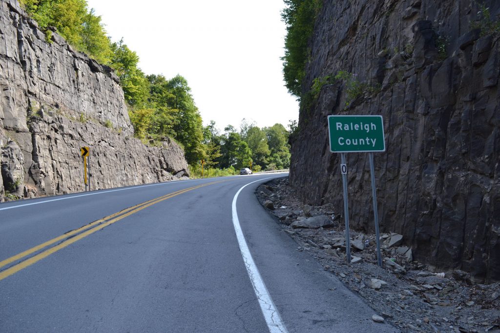
Boone County /
Raleigh County
Location: Rt 3, on south end of Whiteseville, appx 300 yards north of junction with CR 1 (Clear Fork Road)
MISSING ON 21 AUGUST 2023
GPS:
37* 58′ 15″ N, 81* 31′ 48″ W
37.970915 N, 81.530090 W
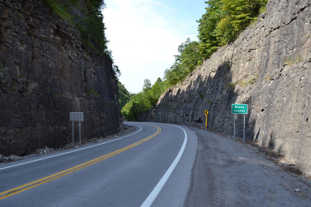
BOONE COUNTY /
RALEIGH COUNTY
LOCATION: RT 99, APPX 2 MILES EAST OF RT 85
MISSING ON 21 AUGUST 2023
GPS: APPX
37* 47′ 30″ N, 81* 30′ 53″ W
37.791803 N, 81.514881 W
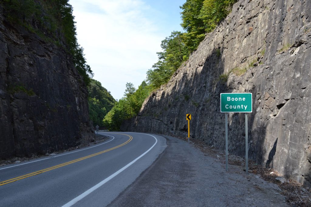
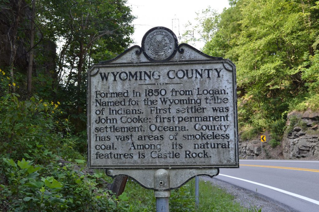
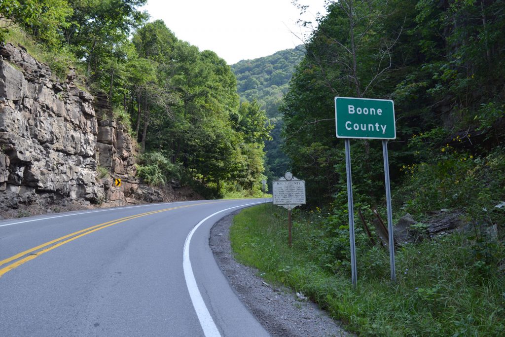
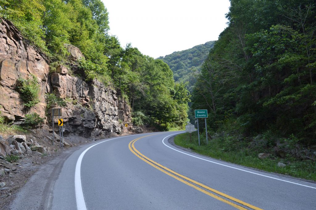
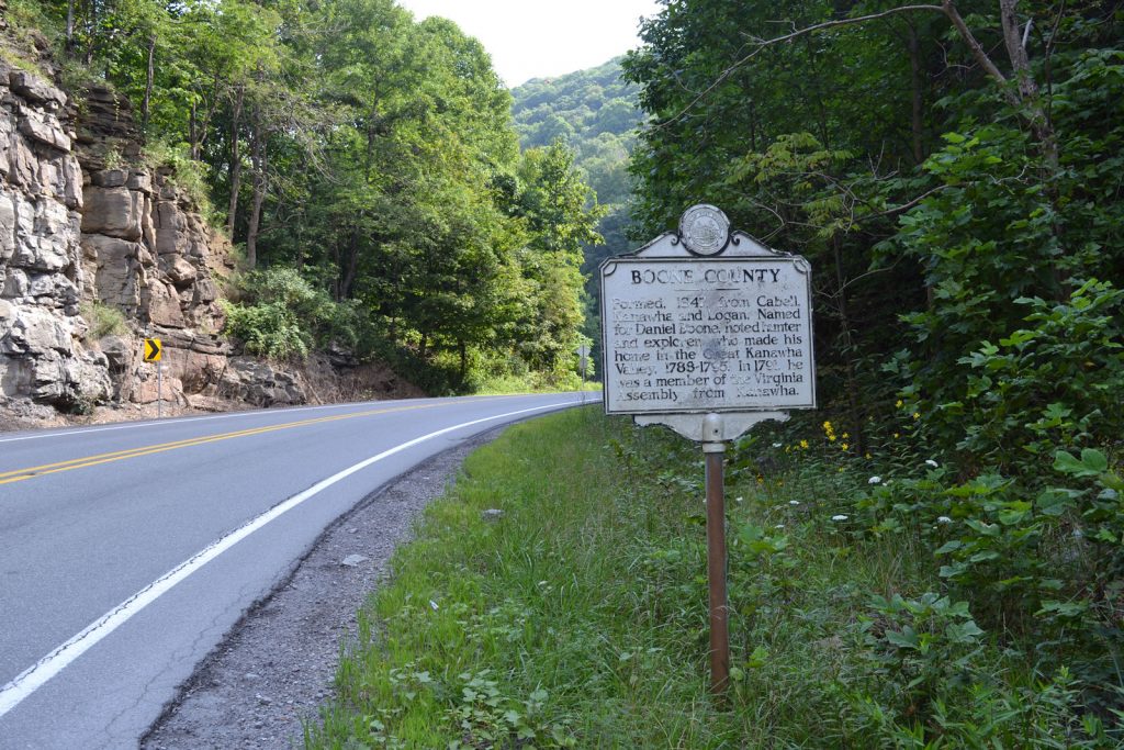
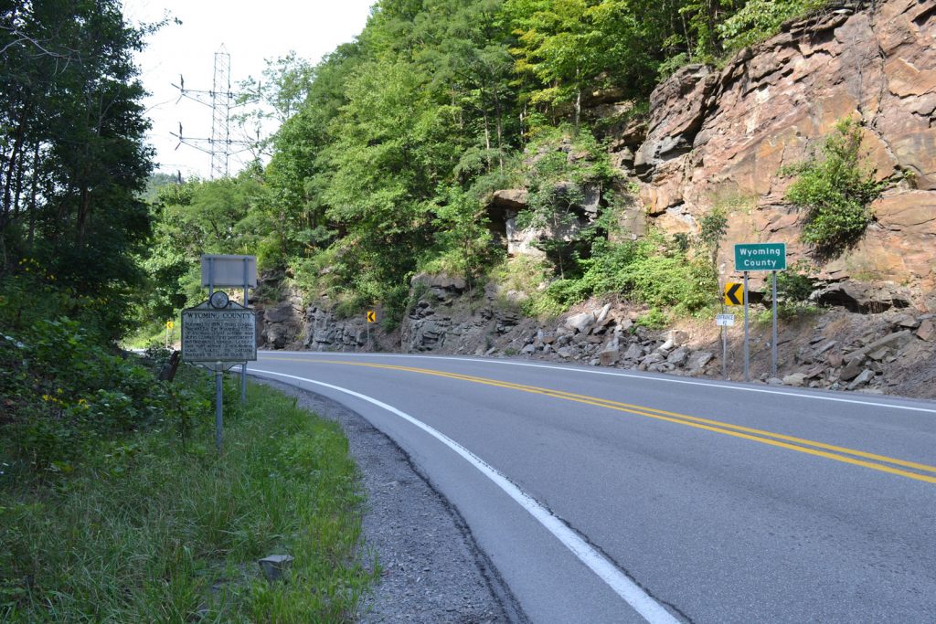
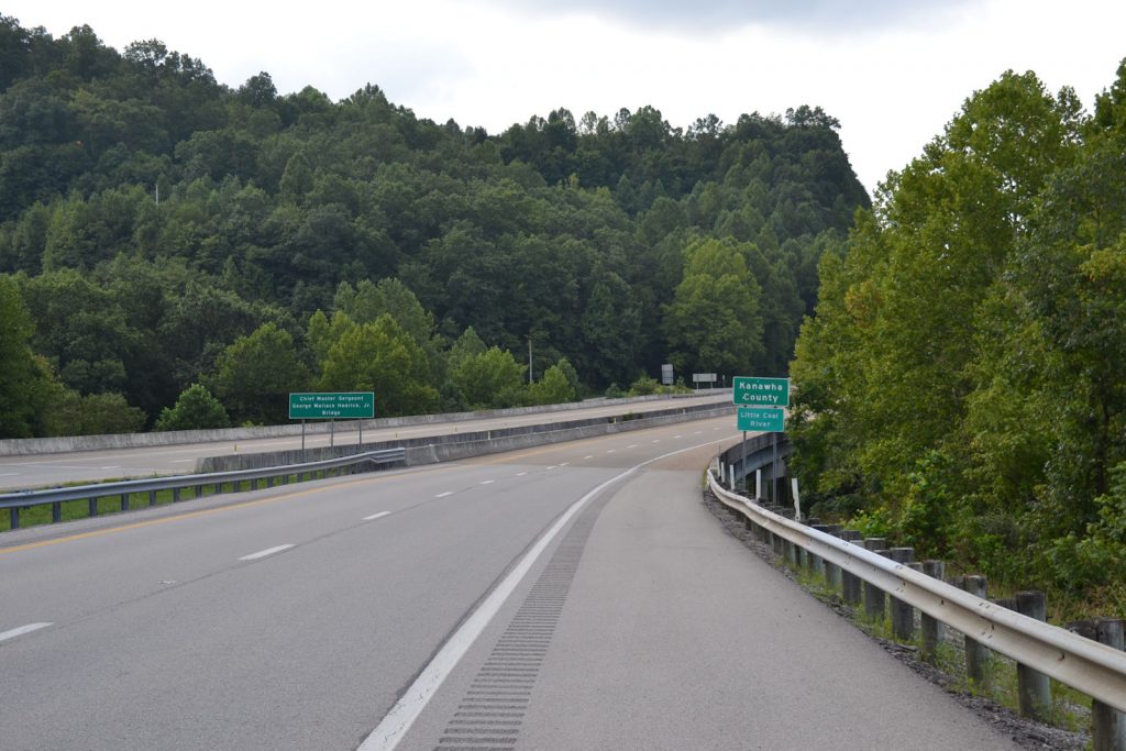
Boone County /
Wyoming County
Location: Rt 85, appx 28 miles south-east of Madison, appx 1/2 mile south of junction with Rt 99
PHOTOS 21 AUGUST 2023
GPS:
37* 47′ 00″ N, 81* 32′ 21″ W
37.783362 N, 81.539345 W